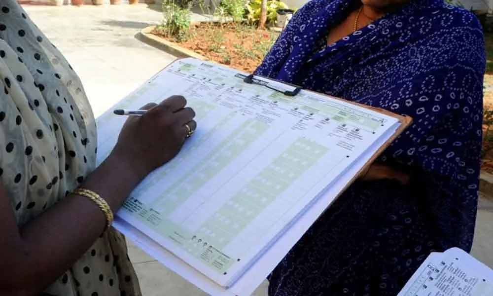
India’s 16th Census - eighth since Independence - has finally begun, and for the first time, it will be conducted entirely through digital means. It is also notable that the Census will include caste enumeration for the first time since 1931.
Today, the Census remains the country’s most comprehensive source of primary data, covering everything from housing conditions and economic activity to literacy, migration, religion, and the population of Scheduled Castes and Scheduled Tribes - all the way down to the village, town, and ward level. It is the data backbone on which most government planning, scheme design and resource allocation ultimately rest. The Census Act, 1948, and the Census Rules, 1990, provide the legal foundation for the Census.
Though the Census of India enumerates everyone, including those who live in Tolas, Majras, Paras, and the dozens of other names by which sub-village hamlets are known across India, it publishes data only up to the village level.
The hamlet gets absorbed into the village aggregate, and from that point on, it ceases to exist as a separately identifiable unit in any official database. The result is that when a scheme requires hamlet-level data, every state department is left to figure it out on its own - conducting fresh surveys, pulling panchayat and block officers away from their actual work, knocking on doors.
This is not a minor administrative inconvenience. It is a structural gap at the very foundation of India’s rural governance.
The word ‘village’ in Indian policy documents carries a quiet assumption: that it is a single, coherent settlement. It is rarely that. Across rural India, what the Census records as a single revenue village is often a cluster of smaller, distinct habitations - each with its own social identity, geography, and often caste composition.
These hamlets go by different names depending on where you are. In Uttar Pradesh and Madhya Pradesh, they are Majras and Tolas. In Tripura, Paras. In Manipur, Khunou. In Karnataka, Hadi or Palya. In Andhra Pradesh, Khandrika. In Tamil Nadu, Kuppam. The names differ; the reality is the same. These are real places where real people live, often at a distance from the main village, invisible to most government databases.
When a scheme says it will reach ‘every village,’ it almost always reaches the dominant settlement within that revenue unit. The Tola at the edge — home to scheduled caste or tribal families - is statistically invisible.
Sociologists have long noted that hamlets are not random. Historically, they are where the marginalized communities live - Dalit households on the edge of the village, the tribal settlements beyond the fields. If the data cannot find you, the scheme cannot find you either.
The Pradhan Mantri Gram Sadak Yojana (PMGSY) requires a habitation to meet a minimum population threshold before a road can be sanctioned - 500 persons in general areas, 250 in special category regions, and 100 under recent revisions.
The Census has counted the people living in those habitations. But since that count is only at the aggregate village level, it cannot tell you how many of those people live specifically in Majra A versus the main village. A local team must therefore physically survey the hamlet from scratch. This creates unnecessary delays.
The Jal Jeevan Mission aims to provide tap water to every rural household. It plans based on village-level data. But within a village, a Majra situated half a kilometre away may have households that are structurally difficult to connect under the same scheme design, because Census data is not available at the Majra/ Tola level.
Mission Saksham Anganwadi and Poshan 2.0 allow Mini-Anganwadi centres in rural/urban areas with populations between 150-400, in Tribal/ Riverine/ Desert/ Hilly and other difficult areas with a population of 150- 300. The PM-JANMAN scheme allows an Anganwadi in the habitations of particularly vulnerable tribal groups (PVTGs) with as few as 100 persons. These are sensible provisions. But they are hard to operationalise without knowing which hamlets actually have those populations.
In such cases, departments end up conducting their own ad-hoc surveys - different methodologies, non-comparable data, results that cannot be verified centrally or integrated with national databases.
It is worth pausing to ask why this gap exists in a Census that has been running for 150 years.
The answer lies in the original purpose of the Census. The first synchronous Census of 1881, under British colonial administration, was not a welfare instrument. Scholars like Bernard Cohn have documented that it was fundamentally a tool of administrative control - designed to classify and render Indian society legible for colonial governance. The revenue village was the unit of taxation. What happened inside it - which hamlet, which family - was not the colonial state’s concern.
That administrative logic, with remarkable durability, has survived into independent India’s Census design. We have a Census Act from 1948, a constitutional welfare mandate, and hundreds of government schemes. But we are still counting the same units the British revenue collector counted. That is an inertia we can no longer afford.
The solution lies not in a redesign of the Census, but in the deliberate inclusion of one key component.
The Census enumerator already visits every household. Adding a hamlet identifier - pre-printed on the enumeration schedule - requires no additional fieldwork, no extra personnel, and only marginal additional cost. The enumerator records which Tola or Majra they are in, just as they currently record the village. That is the entirety of the operational change.
What this creates is transformative: for the first time, every hamlet in India would have an official population count, a household count, and - if geo-tagged — a unique code in the national system. Every department planning a scheme with a population threshold criterion could access this data directly, without a parallel survey, without duplication, without delay.
The recommendation is simple: in the upcoming census, the Office of the Registrar General (ORGI) should expand its survey frame to capture data at the Tola, Majra, and sub-village habitation level. And the Local Government Directory (LGD) framework should be extended to assign unique, geo-tagged codes to every recognised hamlet.
India’s constitutional commitment under Article 46 - to protect Scheduled Castes and Scheduled Tribes - means little if schemes cannot locate those citizens in the data. The Finance Commission devolves funds. Budgets are allocated. Schemes are designed. And then, at the last mile, the system loses track of where the most marginalized actually are - because they live in a hamlet that was never separately counted.
The 16th Census has already started, and currently, it may be impossible to modify existing Enumeration Blocks (EBs) or House Listing Blocks (HLBs) . The Census should instead adopt a flexible, questionnaire-based method to capture data for small settlements like Majras and Tolas. By inserting two specific data fields-a binary “Yes/No” regarding hamlet residency and a text field for the hamlet’s name - create a dynamic master list of these locations as the Census progresses.
Adding digital fields to the household questionnaire is a low-impact, simple exercise that will not disrupt the Census system. By allowing the names of hamlets to be populated during the enumeration process, the government gains the ability to retrieve granular, hamlet-wise data that was previously obscured. The hamlet-level data collection will facilitate better localized planning and ensure that these smaller inhabited spaces are officially recognized and accounted for in national statistics.
India is conducting its 16th Census now, and this is a once-in-a-decade opportunity to correct the structural gap that has existed since the colonial era.
Kumar Ratan is working as a Senior Consultant at Madhya Pradesh Rajya Niti Aayog, and the views expressed here are personal.
TA is a Bhopal-based policy and development consulting group. We are on a mission to make the development space more inclusive and democratic for students and professionals. Join us on this mission.